GPSMAP 640 Owner’s Manual 41
Marine Mode: Advanced Conguration
Data Bar Setup—specify the position of the data bar on the
Navigation chart, and specify the contents of the elds.
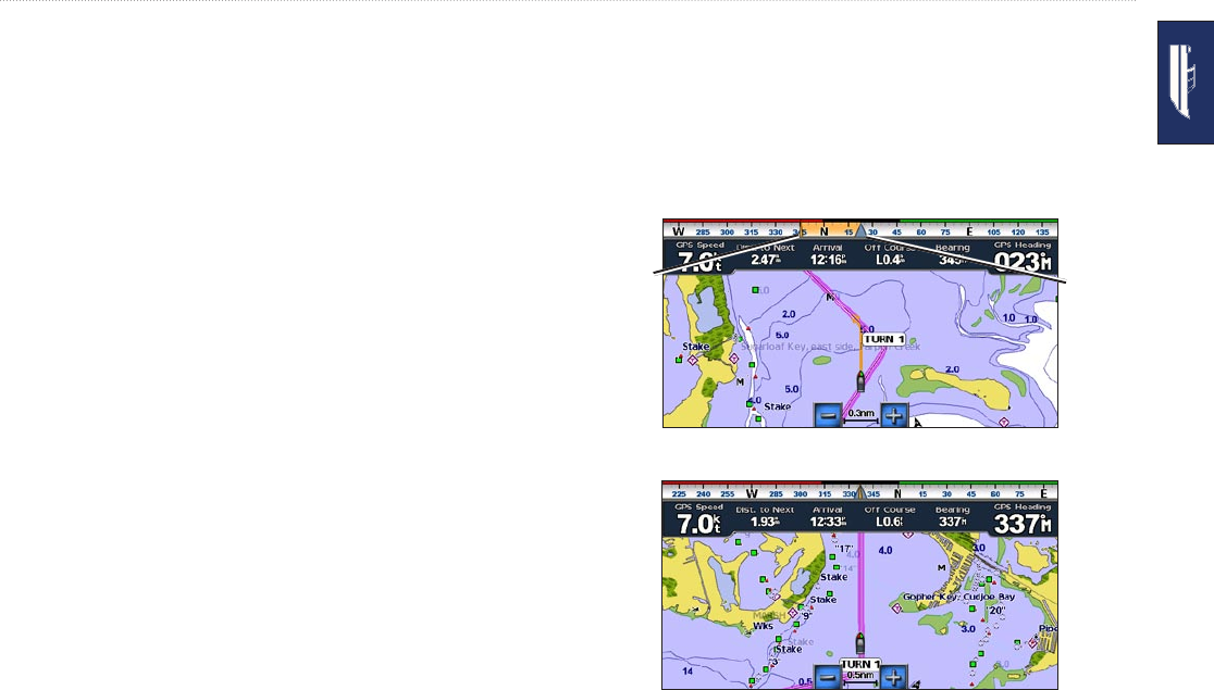
Navigation: GPS speed, distance to destination, arrival (time),
off course, bearing (to destination), and GPS heading. When
set to Auto, these numbers appear only when navigating to a
destination.
Data Bar Setup—toggle the Route Leg data eld (shows
additional route information) and specify how each
data eld provides navigation information (by time or
by distance).
Fishing: Depth, water temperature, and water speed. Depth,
temperature, and water speed are only available when connected
to a sonar unit.
Sailing: Water speed, wind speed, wind angle, and Wind
Velocity Made Good (VMG). Wind speed, angle and VMG
are only available when connected to an optional NMEA 0183
wind sensor. See page 43 for more information on how the
chartplotter displays Wind VMG and Waypoint VMG.
Wind—choose the type of wind data used in the sailing data
elds (apparent or true).
◦
•
◦
•
•
◦
Compass Tape: Displays the current heading. An indicator
that shows the bearing to the desired course is displayed while
navigating.
When you are off course, the distance between your current
heading and the corrected course is called the Course to Steer,
and is shaded orange on the compass tape.
Heading
indicator
Bearing
indicator
Compass Tape – Off Course
Compass Tape – On Course
•