


12-2
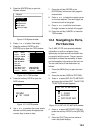
4. Press ! or " to select the item desired.
5. Press the soft key ENTER or the
[ENTER] key to display details for object
selected Objects.
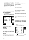
Caution area
Information
LEUCTEUE DIE ATE ENTAEL
T NU DIE LAGEN DE ICTIGEN
EUE. LIGTS ONL TE PINC
IPAL LIGTS AE SON ON TIS
CAT. MISSEISUNG SIEE
ATEN GOESSEEN MASSSTAS. M
AGNETIC AIATION LOCAL MAGNE
TIC ANOMALIES SEE LAGE SCAL
E CATS.
Figure 12-4 Example of caution area window
6. Press the soft key CANCEL to close the
window.
7. Repeat step 4 to 6 to select other item.
8. Press the soft key CANCEL to close the
Objects window.
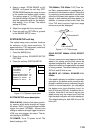
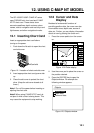
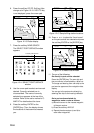
When you place the cursor on any icon, its
information appears.
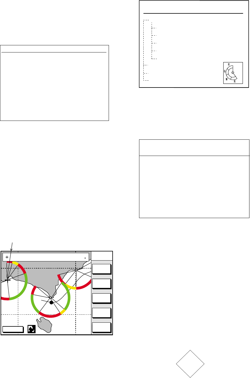
1. Place the cursor on a lighthouse icon.
DGPS 3D
CENTER
GO TO
CURSOR
COURSE
UP
ZOOM
OUT
ZOOM
IN
NORTH
UP
NAVAID : X X X X X X 6S 7m 9M
FROM OS 2. 43nm 351. 2
Place the cursor
on a lighthouse icon.
Figure 12-5 Lighthouse icon
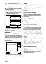
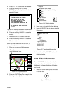
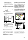
2. Press the [ENTER] key. For example, the
following window appears.
Objects
Navigation mark, fixed
Extended navigational aid, ge
Light
Light
Light
Light
Depth contour
Land area
Source of data
Figure 12-6 Object windows
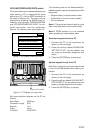
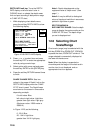
3. Press ! or " to select the item desired.
4. Press the [ENTER] key to display detailed
information.
Color
white
Height
7. 00 Meters
Light characteristic
occulting
XXXXXXXX
XXXXXXXX
Navigation mark, fixed
Light.
Figure 12-7 Sample lighthouse data
5. Press the soft key CANCEL to close the
Objects window.
12.3 Tidal Information
The C-MAP NT-FP chart card provides for
calculation of the tide heights for any date.
Additionally it displays the times of sunrise
and sunset.
1. Press the cursor pad to place the cursor
on a Tide icon.
T
Figure 12-8 Tide icon