


NX501/NZ501English84
5Glossary
2D/3DGPSreception
TheGPSreceiverusessatellitesignalstocalculateits(your)positionandneedsatleastfoursignalsto
giveathree-dimensionalposition,includingelevation.Becausethesatellitesaremovingandbec ause
objectscanblockthesignals,yourGPSdevice mightnotreceivefoursignals.Ifthreesatellitesare
available,thereceivercancalculatethehorizontalGPSpositionbuttheaccuracyislowerandtheGPS
devicedoesnotgiveyouelevationdata:only2Dreceptionispossible.
Activeroute
Thecurrentlynavigatedroute.Wheneverthedestinationisset,therouteisactiveuntilyoudeleteit,reach
yourdestinationoryouquitClarionMobileMap.Seealso:Route.
CityCenter
Thecitycenterisnotthegeometriccenterofthecitybutanarbitrarypointthemapcreatorshavechosen.
Intownsandvillages,itisusuallythemostimportantintersection;inlargercities,itisoneoftheimportant
intersections.
Colortheme
ClarionMobileMapcomeswithdifferentcolorthemesfordaytimeornightuseofthem apandmenu
screens.Themesarecustomgraphicsettingsandtheycanhavedifferentc olorsforstreets,blocksor
surfacewatersin2Dand3Dmodes,andtheydisplayshadesorshadowsindifferentwaysin3Dmode.
Onedaytimeschemeandonenightschemeisalwaysselectedforthemapandforthemenus.Clarion
MobileMapusesthemwhenitswitchesfromdaytonightandback.
GPSaccuracy
Severalfactorshaveimpactonthed eviationbetweenyourrealpositionandtheonegivenbytheGPS
device.Forexample,s i gnaldelayintheionosphereorr eflectingobjectsneartheG PSdevicehavea
differentandvaryingimpactonhowaccuratelytheGPSdevicecancalculateyourposition.
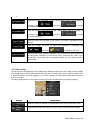
Map
ClarionMobileMapworkswithdigitalmapswhicharenotsimplythecomputerizedversionsoftraditional
papermaps.Similarlytothepaperroadmaps,the2Dmodeofdigitalmapsshowyoustreets,roads,and
elevationisalsoshownbycolors.
In3Dmode,youcanseethealtitudedifferences,forexamplevalleysandmountains,elevatedroads,and
inselectedcities3Dlandmarksand3Dbuildingsarealsodisplayed.