


NX501/NZ501English12
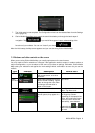
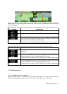
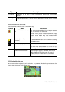
Tapanyofthedatafieldstosuppressothersanddisplayonlytheselectedone.Thedatafieldsare
differentwhenyouarenavigatinganactiverouteandwhenyouhavenospecifieddestination(theorange
lineisnotdisplayed).
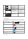
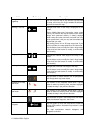
Defaultdatafieldswhencruisingwithoutadestination(tapandholdanyofthefieldstochangeitsvalue):
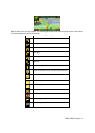
Field Description
ShowsyourcurrentspeedgivenbytheGPSreceiver.
Showsthespeedlimitofthecurrentroadifthemapcontainsit.
Showsthe currenttimecorre cted withtime zoneoffset.The accuratetime
comesfromtheGPS satellites,andthetimezoneinformationcomesfromthe
maporitcanbesetmanuallyinRegionalsettings.
(Thecurrenttimeisalwaysdisplayedinthetopleftcornerofmenuscreens.)
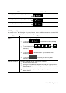
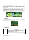
Defaultdatafieldswhennavigatingaroute(tapandholdanyofthefieldstochangeitsvalue):
Field Description
Showsthedistanceyouneedtotravelontheroutebeforereachingyourfinal
destination.
Showsthetimeneededtoreachthefinaldestinationoftheroutebasedon
informationavailablefortheremainingsegmentsoftheroute.
Thecalculationcannottakeintoaccounttrafficjamsandotherpossibledelays.
Showsthees timatedarrivaltimeatthefi naldestinationoftheroutebasedon
informationavailablefortheremainingsegmentsoftheroute.
Thecalculationcannottakeintoaccounttrafficjamsandotherpossibledelays.
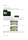
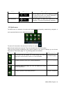
2.2.2Positionmarkers
2.2.2.1VehimarkerandLock-on-Road
When your GPS position is available, Clarion Mobile Map marks your current position with the
Vehimarker.Bydefault,thismarkerisaredarrow,butyoucanchangethisiconinSettings.