


OSIM | Project: EG2L | Resolution-Width: 960 | Resolution-Height: 540 | Language: English
55/ 138 | File AQUA_Paprika_OSIM_GBAEP_090807.fm | Created at March 19, 2008 | Modified at September 29, 2009 10:07 am
Previous Next Table of Contents
Select Back
<auto-generated>Playing back Photo/Music/Video via USB
[L]
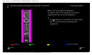
• A map can be displayed in the case of
photograph’s Exif data includes a date
information, and the associated longitude and
latitude information (“Log files”) has been
recorded using a Sony GPS unit. Follow the
procedure described below.
1 Connect the GPS unit to the USB port.
2 Press HOME.
3 Press to select “Photo”.
4 Press to select the GPS unit, then press
.
5 Select the following items using , then set
them using .
- Time Zone
- DST
6 Select “OK”, then press .
The GPS log files are loaded.
7 Disconnect the GPS unit and connect the
device on which the photograph is stored.
8 Select a photograph (49).
9 Press the green/red buttons to zoom in/out on
the map.