


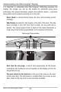
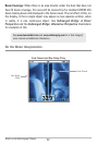
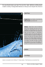
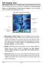
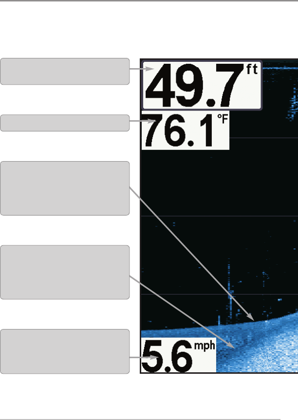
What’s on the Down Imaging™ Display
Down Imaging™ uses unique sonar technology to provide information about
produce the detailed sonar data that you see on the display. Down Imaging™
and bottom contour, including the following items:
26
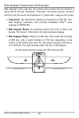
What’s on the Down Imaging™ Display
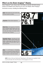
Depth - Water depth can be set to alarm when
the water becomes too shallow.
Temperature - Water surface temperature.
Speed - If a GPS Receiver or Temp/Speed
accessory is connected, the Fishing System can
display the speed of the boat and can keep a
Triplog of nautical or statute miles traveled.
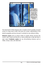
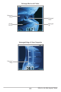
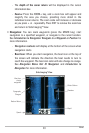
Topography Changes - The light part of the
display shows where the beam is hitting hard
bottom or rising terrain. The dark part of the
display indicates soft bottom (sand, mud) or
descending terrain.
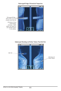
Bottom Return- Use the appearance of the bottom
return to determine bottom hardness. Rock and
gravel provide a clearer sonar return than
mud and sand because hard objects reflect
sonar better than soft objects.
NOTE: Entries in this view that list (with Temp/Speed or GPS Receiver) are available if either
only the information from the GPS receiver will be displayed on the view.