


78-8130-6150-0 Rev G 53
When the receiver is communicating with a GPS
device, the LAT and LONG coordinates received
from the GPS device will appear on the marker
locate display.
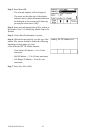
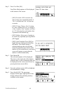
1. Locate a marker (See 13.C, Single Marker Locating.)
2. Press Read [SK]
The information from the 3M
™
iD Marker, as well as the GPS coordinates, will display
on the receiver display. This information is saved automatically in the Read Marker
History. (See 17. Reviewing Marker Read/Write History.)
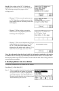
If the marker is a passive marker (rather than iD) the receiver will display “No iD
Marker Found”. The GPS coordinates of the attempt to read the non-iD marker are
stored in the Read Marker History as serial number # 0000-0000-0000. The marker
details will indicate “not an iD marker”, but will display the GPS coordinates.
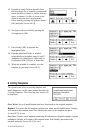
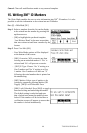
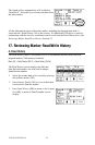
C. Sending 3M iD Marker Data to GPS (Capture-Transmit Mode / Mode
2)
Menu [6] + COM Setup [SK:3] + GIS
Receivers that have marker locating capability (indicated by ‘iD’ in the model number)
can be configured to send 3M
™
iD Marker data directly to some GPS devices. When
an iD marker is located and read, the information read from the iD marker with feature
and attribute data is sent to the GPS device and is stamped with latitude, longitude and
date/time data. The data acquired during this logging process can be uploaded to GIS
mapping software. For more information and detailed instructions pertaining to specific
GPS devices, refer to www.3M.com/dynatel for GPS instruction sheet.
D. Path Mapping with GPS
The M-Series cable and pipe locators are compatible with hand-held GPS devices and
now have the ability to map the path of underground target facilities. While measuring
the depth to the target, the technician can automatically log the coordinates of the path to
the GPS device. These logged points contain the Trace template that can have valuable
information regarding the facility (owner, utility, size, etc.) and the method used to find
the path (frequency, current, and measured depth).
In order to transmit the path information to a GPS device, the GPS has to have the
ability to accept information on one of its com ports at 4800 Baud. Using the manual
supplied with the GPS device, configure the com port of the GPS to communicate with
the receiver.
If ArcPad
™
Software is the mapping software on the mobile device, download the 3M
software application script from the website: www.3M.com/dynatel
With ArcPad
™
application installed, the receiver will send the path information (locate
frequency, depth, current, and trace template information) into the software program as a
logged point and can be saved as a .shp file.