


26
Some Outdoor Stuff
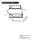
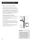
Precise Site Survey
In Chapter 1, you conducted a general site survey to find the
location or locations that will provide the dish with a clear line of
site to the satellite. Now you’ll use a compass to make a more
precise survey.
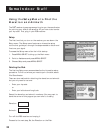
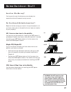
Using a Compass to Find the Satellite
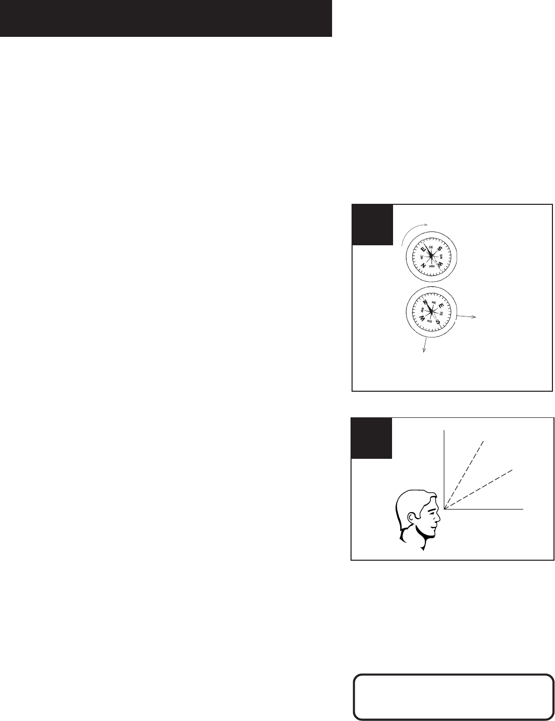
1. Go outside and hold the compass flat in the palm of your
hand. Hold your hand still until the needle stops moving (the
dark or colored half of the compass needle always points
north).
2. Rotate the compass so that the “N” (for north) is directly
under the dark part of the compass needle. Your compass is
now aligned with north. The tick marks around the edge of
the compass represent azimuth degrees.
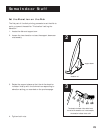
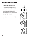
3. Locate the tick mark on the compass that corresponds to the
azimuth number you wrote down on page 22. (Don’t you
wish you had dog-eared that page?) Point your arm in the
direction of your azimuth setting.
4. Raise your arm to approximately the elevation angle you
wrote down on page 22.
5. Repeat this survey in several places on your property.
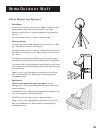
Remember...
To get a signal, the DSS
®
dish will have to be pointed directly at
the satellite, with NO obstructions between the two. This means
NO trees and NO buildings. Take into consideration future tree
growth, house remodeling or additions and new construction in
your area.
The satellite signal WILL NOT PASS through leaves or branches.
The satellite signal WILL NOT PASS through glass; don’t try to
install your dish indoors!
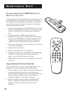
Try to keep the compass away from
any metal objects. Metal objects can
cause inaccurate compass readings.
Rotate until N lines up with the
dark half of the arrow
If you live in Miami,
satellite will be to
the Southwest
If you live in San Francisco,
satellite will be to
the Southeast
Rotate until N lines up with
the dark half of the arrow
If you live in Miami, satellite
will be to the Southwest
If you live in
San Francisco,
satellite will be to
the Southeast
1-3
90°
0°
30°
60°
4